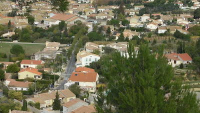
Spring Time, on Thursday 11 November afternoon, we took the opportunity to get to a golf MOUSSAN for 5 or 6 km which was unearthed on Topoguides The Land of Narbonne, called "Trail Plana ".
........................................
Leaving the village hall, road CUXAC direction, turn immediately right into rue Soldiers. Hence, the long straight avenue de la Cave Cooperative and the Avenue de la Promenade.
No problem if the rest did not record the route is well marked (yellow).
...............................
After 600 m, does not continue the right turn but take the street on the left which leads to a path along a few houses. Barely 250 m and turn right.
...............................
the 300 meters, the trail climbs fairly steep slope. A staircase log makes it easy.
Access to the plateau of Baden (110 m) and that's the orientation table, stone, surmounted by a semicircular plate with the whole panorama:
Peak NORE, THE SOMAIL, SALLELES-d'Aude, Mount Caroux, CAPESTANG, ENSERUNE, LESPIGNAN the Mont St. Clair VINASSAN, Air Base, ...
Bravo! The creators of this space have done a good job!
..............................
We take the road to the left of the table and down the western slope. We leave the broad road 250 m further to slide down a trail in the middle of the forest. Still
400 m and we find ourselves on a paved road, take to left.
............................
The Chapel of St Lawrence is 400 m. Built in the 9th century, then abandoned for more than half a century, it was restored through the St. Lawrence Committee.
A grid does not enter but you can see everything that is within a few frames on the walls and especially the wonderful architecture for those who are lovers of old stones.
..................................
We continue our journey and cross 200 m below the D69 leading to the D607 (MARCORIGNAN - Narbonne). After 500 m this way, a crossing occurs, turn right.
a walker arrives at the path that faces us, she just MARCORIGNAN, we decided to make a small hook, 1 km return.
................................
We then resume the planned route in a straight line on a wooded plateau at 80 meters. We meet a few joggers and walkers, normal with this weather and return to MOUSSAN after 5.5 km Chemin des Arenes then Avenue des Quatre Chemins.
................................
Before leaving the village you must enter the lanes constituting the "Circulade (Boulevard des Remparts): the place of separation where the church, the High Street and the Rue Basse, Rue de la Concorde. not made for cars, these picturesque streets!
.................................
Back in the car, a sign reminds us that another route has been traced here, the circuit of shad, MOUSSAN soon!  Street Soldiers to MOUSSAN
  Turn right
  The staircase log
  The climb continues
  Another effort
  Orientation table


 Church in downtown
  Avenue de la Promenade
  Mount Caroux off
  Beautiful fall colors
  In the forest of Plana
  main wall of the Saint- Lawrence
  The explanatory plaque
  overview within
  On the right side
  At bottom right
  At bottom left
  The steeple
  Along the D69
  Towards Lebret
  Church of MOUSSAN
  The Circulade (Google Earth)
 VIDEO (1mn50s)
0 comments:
Post a Comment